August 9-18, 2010 Beaver Island, Michigan 45.7490,-085.5112
The North Channel is coming to an end, so now we are planning the next leg of our trip which will take us down the East shore of Michigan. After clearing customs, our first stop will be Mackinaw City and Mackinac Island. Now these two names give me pause. They are nearly spelled the same except the city has a “w” on the end, and the island has a “c” on the end of its name; yet, they are both pronounced the same, which is “Mack-i-n-aw”. Go figure. The meaning of the word is giant turtle. — I am onto Artie and the reason why he wants to visit Mackinaw City and Mackinac Island. After some reading I found out that since the 1920’s FUDGE is the number one sweets souvenir. Actually, it is more than that; there are only two items listed under “Industry”. One is tourism, and guess what the second items is. Yup, fudge. There must be at least 50 fudge shops here, which Mr. Hubert will surely visit (and probably ask for “samples”). He’s in “Fudge Heaven.” What a rascal!
 August 9-11. We stayed at Beardrop Island an extra day due to fog, so we passed by Turnbull Island and headed to Drummond Island, Michigan at 7am sharp. YES, that’s right, Michigan as in the USA!! We’re backkkkkk! :-). We docked and cleared customs by 4pm, then headed to the grocery store. The weather seems to have increased by about ten degrees. “Borrowed Horse” is still with us and we are having dinner with them tonight. They are a fun couple and it’s nice cruising with them. What’s even better is that their home is in North Carolina not very far from Sneads Ferry. 🙂 — Drummond Island, Michigan is the second largest fresh water island in the nation 249 sq. miles, population 992). An interesting bit of information about this island is 1) there are no ticks, and 2) there are no skunks. Sounds like they must be doing something right. Another bit of interesting info is, if you’re lucky, it’s possible to see the Aurora Borealis (Northern Lights) here. No one can predict when it will appear, but we’ll stay up until midnight looking at the northern horizon. You never know….
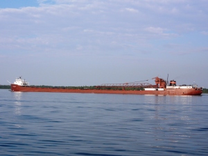 After 15 minutes into our trip, already we are meeting up with not one but two container/freighter ships on our starboard side. That will help warm us up for the Illinois and Mississippi Rivers. What a shocking contrast after leaving the tranquil waters of the North Channel only yesterday. Like the saying, “what a difference a day makes.”
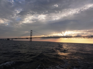
On approaching Mackinaw City we saw the amazing Mackinac Bridge. It spans two peninsulas and connects Mackinaw City with St. Ignace. This bridge “spans five miles” and is the largest in the Western Hemisphere, and the world’s largest total suspension bridge. This bridge was proposed in 1884, and supposedly couldn’t be built. The statistics on this bridge are amazing, such as the total length of the wire in the main cables is 42,000 Miles. The weight of the cables alone is 11,840 tons. Incredible.
Next day, at 7:30am we were on the first ferry to Mackinac Island. After getting some new tubes, tires and brakes for Artie’s bike, we started exploring the Island.
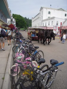
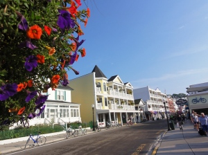
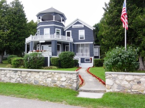
What beautiful tall buildings with flowers everywhere you look. One of the first things that you notice is all the horses. Cars are not permitted on the island; they were banned in 1898. The most common modes of transportation are horse and buggy or bicycle. If biking or walking about, watch out for the horse “bouquets”.
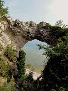
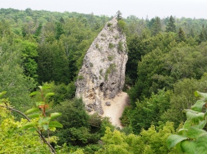
There is an eight mile road around the island (Lake Shore Boulevard, M-185) and is the only state highway where cars are banned. This road is quite picturesque on the blue waters of the lake and passing by some spectacular sights such as Arch Rock.
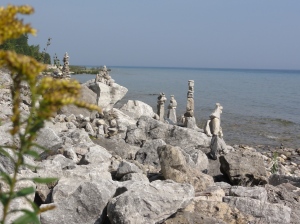
Some visitors to the island stack different size and shape rocks on the beaches. No one seems to know why; perhaps it’s just a way of demonstrating “I was here”.
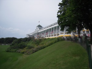
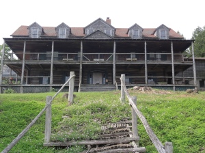
— In 1979 the movie “Somewhere in Time” was filmed at the Grand Hotel (a principal landmark built in 1887) starring Christopher Reeve and Jane Seymour. Also, in 1947 the movie “This Time for Keeps” was filmed at this hotel starring Ester Williams and Jimmy Durante. This hotel truly is “grand” with a 660 foot porch. The hotel is so big you cannot stand in front of it and take a picture to include the structure from left to right so that you can see the details. Mackinac Island is very proud of their Grand Hotel; if you want to “stand on the front porch” you are charged $7. I wonder if there is a fee to look at it? There’s so much to see on the island in one day, but we tried our best, had a good time, and wore ourselves out.
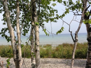
It’s just amazing how beautiful the water is here, clear and blue/green. We are always happy to find places to bike when we visit because exercising is limited on the boat, although we do have some means. — —

Leave a comment